Author: Site Editor Publish Time: 2026-07-17 Origin: Site
Unauthorized unmanned aerial vehicles threaten critical infrastructure, military bases, and restricted airspace. Modern drones use low radar cross-sections and radio frequency-silent navigation to bypass traditional perimeter defenses. Relying solely on radar or RF sensors generates high false-positive rates. These primary sensors lack the visual verification needed for proportional mitigation, like signal jamming or kinetic interception. Security teams struggle to bridge the gap between initial detection and positive target identification within the counter-UAS kill chain. You cannot authorize countermeasures based on a radar blip alone. Integrating a Drone Detection and Tracking Camera provides the mandatory verification layer. Selecting the right optical and infrared payload requires balancing sensor types, tracking algorithms, and integration capabilities. This visual layer turns raw sensor data into actionable intelligence.
Visual Verification is Mandatory: A drone detection and tracking camera transitions a C-UAS system from merely sensing an anomaly to providing actionable, legally defensible identification before mitigation.
Multi-Sensor Fusion Trumps Standalone Optical: The most effective deployments utilize "slew-to-cue" integration, where Radar, RF, or Acoustic sensors direct Pan-Tilt-Zoom (PTZ) cameras to specific coordinates, rather than relying on cameras for wide-area primary detection.
Panoramic Thermal Scanning vs. Targeted PTZ: Complete situational awareness requires balancing continuous 360-degree panoramic infrared detection with high-magnification PTZ tracking payloads.
Environmental Limitations Dictate Payload: Electro-Optical (EO) sensors fail at night or in fog; Mid-Wave/Long-Wave Infrared (MWIR/LWIR) sensors are required for 24/7 operational readiness and heat-signature tracking.
AI-Driven Trajectory Tracking is the Differentiator: Modern systems must utilize edge computing to maintain target lock during erratic drone maneuvers or temporary line-of-sight occlusions.
Understanding the operational gap in modern airspace security begins with evaluating primary detection sensors. Radio frequency sensors detect the communication links between a drone and its operator. They fail completely against pre-programmed, autonomous drones that maintain strict radio silence. Radar systems provide excellent volumetric coverage but struggle with ground clutter. They often misclassify birds or wind-blown debris as small drones due to similar radar cross-sections. These standalone technologies cannot provide the definitive proof required to authorize a countermeasure.
Visual identification establishes a mandatory verification layer. Operators must distinguish between a hostile payload-carrying drone, a lost hobbyist quadcopter, and biological clutter. Initiating a jamming sequence against a commercial aircraft or a friendly drone causes severe operational disruptions and carries heavy legal consequences. High-performance optics allow operators to inspect the airframe, identify attached payloads, and determine the exact model of the intruding aircraft. This visual evidence supports post-incident reporting and legal defensibility.
A Drone Detection and Tracking Camera maps directly to the five phases of the C-UAS kill chain. Security teams execute these phases sequentially:
Detect: Cameras act as secondary confirmation to initial anomaly sensing from radar or RF.
Classify: The optical feed helps group the target into categories like rotary-wing, fixed-wing, or biological.
Track: The system relies on dynamic trajectory plotting, keeping the target centered in the frame.
Identify: Operators use high magnification to confirm specific payloads and intent.
Mitigate: The camera directs precise kinetic or non-kinetic neutralization by providing real-time 3D coordinates.
We must contrast cooperative and non-cooperative tracking methodologies. Cooperative tracking relies on transponders, Remote ID, or Unmanned Traffic Management systems where the drone broadcasts its location and identity. Hostile threats are inherently non-cooperative. They spoof GPS, disable transponders, and fly low to evade detection. Passive visual tracking remains the most reliable method for maintaining a lock on non-cooperative targets. Optical sensors do not rely on the drone transmitting any signals, making them immune to electronic silence tactics.
Electro-optical sensors are high-resolution visible light cameras designed specifically for daytime identification. They capture the visible spectrum, providing operators with full-color, detailed imagery of the target. These sensors utilize advanced CMOS technology and powerful optical zoom lenses to magnify distant objects without losing clarity. During daylight hours, EO sensors deliver the highest level of detail available in the C-UAS technology stack.
The success criteria for an EO sensor depend heavily on its ability to identify specific drone models and payload types. Operators need to see if a drone is carrying surveillance cameras, chemical dispersal units, or improvised explosives. High-end EO cameras can read serial numbers or specific markings on the drone's chassis at significant ranges. This level of detail supports threat assessment and subsequent law enforcement investigations.
EO sensors carry inherent limitations. They are highly susceptible to adverse weather conditions, severe glare, and low-light environments. Heavy rain, dense fog, or industrial smoke will blind a standard visible-light camera. Pointing an EO sensor near the sun can wash out the image entirely. Because drone incursions frequently occur at night or during inclement weather, relying solely on EO sensors leaves critical security gaps.
Thermal sensors detect the heat signatures generated by drone motors, batteries, and friction against the air. They operate independently of visible light, making them highly effective in complete darkness. By measuring temperature differences between the drone and the surrounding sky or ground background, infrared cameras create a high-contrast image. This capability ensures 24/7 operational readiness regardless of lighting conditions.
Panoramic 360-degree infrared sensors provide continuous scanning capabilities. These thermal cameras rotate rapidly, offering real-time spatial awareness across the entire horizon. They detect multiple targets simultaneously, acting as an optical radar. This continuous scanning detects swarm attacks or simultaneous incursions from different vectors. It provides a comprehensive thermal map of the surrounding airspace.
Mid-Wave Infrared (MWIR) sensors offer superior performance for long-range detection. They provide high-contrast imaging even in highly humid environments where other sensors degrade. MWIR cameras typically require active cooling mechanisms to achieve their extreme sensitivity. Long-Wave Infrared (LWIR) sensors utilize uncooled microbolometers. They are highly effective for shorter ranges and offer excellent reliability with minimal maintenance requirements. LWIR is often preferred for mobile deployments or perimeter defense where targets are closer.
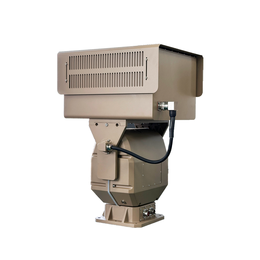
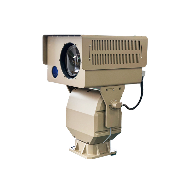
The industry standard for counter-drone optics involves combining EO, IR, and Laser Rangefinders on a single high-speed Pan-Tilt-Zoom positioning system. This multi-sensor configuration provides maximum flexibility. The PTZ mechanism allows the cameras to rotate 360 degrees continuously and tilt vertically to track targets directly overhead. Heavy-duty brushless motors ensure the camera can pan fast enough to keep up with high-speed fixed-wing drones.
Integrating an eye-safe Laser Rangefinder provides highly accurate 3D coordinates. The LRF pulses a laser at the target, measuring the exact distance. Combined with the PTZ's azimuth and elevation data, the system calculates the drone's precise altitude and geographical location. This active rangefinding directs downstream mitigation systems, such as RF jammers or kinetic interceptors, which require exact targeting data to be effective.
This architecture delivers a massive operational advantage. Operators can seamlessly switch between thermal tracking and optical identification depending on environmental variables. If a drone flies into a cloud bank or the sun sets, the operator simply switches to the thermal feed without losing the target. This redundancy ensures continuous tracking throughout the entire engagement cycle.
| Sensor Type | Primary Function | Key Strengths | Operational Limitations |
|---|---|---|---|
| Electro-Optical (EO) | Daytime visual identification | Full color, high resolution, payload verification | Fails in darkness, fog, and heavy rain |
| MWIR (Cooled) | Long-range thermal tracking | Extreme sensitivity, cuts through high humidity | Requires periodic cooler maintenance |
| LWIR (Uncooled) | Short to mid-range thermal detection | High reliability, zero cooler maintenance | Lower resolution at extreme distances |
| Laser Rangefinder | Distance and coordinate measurement | Pinpoint 3D targeting data for mitigation | Requires direct line of sight to the target |
Evaluating camera specifications requires applying the Johnson Criteria, a standard methodology for determining sensor performance. This framework calculates the required pixels on target to achieve specific operational goals. Detection means the system recognizes an anomaly exists in the airspace. Recognition confirms the anomaly is indeed a drone and not a bird. Identification provides the granular detail needed to confirm it is a specific commercial model carrying a hostile payload.
Focal length and continuous optical zoom directly impact the ability to maintain these DRI standards at varying ranges. A camera with a massive optical zoom lens can put more pixels on a distant target, pushing the Identification range further out. Digital zoom is largely useless for C-UAS applications, as it merely enlarges existing pixels and degrades image quality. You must evaluate the true optical focal length when determining the maximum effective range of the system.
Environmental factors heavily influence real-world DRI performance. Atmospheric turbulence, heat shimmer, and humidity scatter light and infrared energy, reducing the effective range of any sensor. When reviewing specifications, ensure the DRI ranges are calculated using realistic atmospheric conditions, not just theoretical laboratory maximums. A camera rated for 5 kilometers in a vacuum may only achieve 2 kilometers in a humid coastal environment.
Algorithmic target lock is the software engine driving modern optical tracking. The system must isolate a drone's pixel cluster from the background and keep it centered in the frame. This auto-tracking capability must withstand erratic flight paths, sudden altitude drops, and high-speed maneuvers. Legacy contrast-based tracking fails rapidly when a drone crosses a visually complex background, such as a treeline or a city skyline.
Occlusion management separates basic cameras from military-grade C-UAS systems. Drones frequently pass behind buildings, trees, or low clouds, breaking the line of sight. Advanced kinematic modeling and trajectory prediction allow the camera software to calculate the drone's speed and heading. The camera continues moving along the predicted path, instantly re-acquiring the target when it emerges from behind the obstacle.
Edge computing provides severe latency advantages over server-side processing. Processing the AI tracking algorithms directly on the camera hardware eliminates network transmission delays. In counter-drone operations, a delay of a few hundred milliseconds means the camera loses the target entirely. Edge processing ensures the PTZ motors receive movement commands instantly, maintaining a tight lock on agile threats.
Deployment environments for counter-drone systems are notoriously harsh. Cameras are mounted on exposed towers, coastal facilities, and mobile tactical vehicles. Ingress protection is non-negotiable. The system requires IP67 or higher ratings to block fine dust, heavy rain, and salt fog corrosion. Internal heaters and defrosters must automatically clear ice and condensation from the exterior lenses to maintain optical clarity.
Active gyroscopic stabilization is critical, especially for mast-mounted or vehicle-mounted deployments. High-magnification lenses amplify even the slightest vibration. Wind shear against a tall mast will cause severe image blur, rendering the camera useless at long ranges. Gyro-stabilization physically isolates the sensor payload from these vibrations, delivering a smooth, trackable image regardless of environmental buffeting.
The mechanical durability of the pan-tilt motors also dictates operational lifespan. These motors must execute rapid, aggressive movements continuously without overheating or stripping gears. Brushless direct-drive motors offer the best performance, providing high torque and precise positioning without the wear and tear associated with traditional belt-driven systems.
The handoff protocol between primary sensors and the optical payload is the backbone of multi-sensor fusion. A primary sensor, such as a 3D radar or an RF scanner, detects an anomaly and generates coordinate data. It sends this NMEA or JSON data stream directly to the camera. This forces the PTZ mechanism to instantly pan and tilt to the threat's exact location in the sky. This automated slew-to-cue process eliminates the impossible task of manually searching the sky with a narrow field of view.
Sensor fusion logic must resolve conflicting inputs intelligently. An acoustic array might detect a drone's sound reflecting off a building from the west, while the radar detects the actual physical target from the northwest. The command software must weigh the confidence levels of each sensor and cue the optical sensor accurately. Advanced systems use Kalman filtering to merge these disparate data streams into a single, highly accurate target track.
Latency tolerance in this handoff is practically zero. Millisecond latency is critical for intercepting fast-moving fixed-wing UAVs. If the radar data takes two seconds to reach the camera, the drone will have already flown out of the camera's field of view by the time the motors finish moving. Hardwired ethernet connections and optimized API protocols are required to ensure the camera receives and executes movement commands instantaneously.
Navigating open architecture versus proprietary ecosystems is a major integration challenge. Vendor lock-in forces you to buy all future upgrades and sensors from a single manufacturer, severely limiting flexibility. You must evaluate the importance of ONVIF compliance and open APIs. These standards allow the camera to integrate seamlessly into existing Video Management Systems, UTM platforms, or unified C-UAS dashboards.
A unified C2 interface reduces operator cognitive load. Security personnel should not have to monitor separate screens for radar, RF, and optical feeds. The camera's video stream, bounding boxes, and AI metadata must overlay directly onto the primary tactical map. This single-pane-of-glass approach ensures rapid decision-making during high-stress incursions.
Network security within the C2 architecture is equally important. The camera must support secure transmission protocols, encryption, and strict user authentication. Hackers often target networked cameras as entry points into broader security networks. Ensuring the optical payload meets stringent cybersecurity standards protects the entire counter-drone infrastructure from remote exploitation.
The risk of false positives plagues many early-generation tracking systems. Cameras frequently lock onto birds, commercial aircraft, or wind-blown debris. This constant misclassification causes severe operator fatigue. If alarms sound continuously for seagulls, operators will eventually ignore the system entirely, creating a massive security vulnerability when a real threat arrives.
Implementing deep learning classifiers mitigates this risk effectively. Modern AI models are trained specifically on drone kinematics and form factors. The software analyzes the target's wing beat frequency, flight trajectory, and rigid body structure. It instantly distinguishes the erratic flapping of a bird from the stable, mechanical flight of a quadcopter. This intelligent filtering drastically reduces false alarms and keeps operators focused on genuine threats.
Continuous neural network training is required to keep pace with new drone models. As manufacturers release new airframes, the AI must be updated to recognize their specific visual and thermal signatures. Selecting a system that allows for over-the-air AI model updates ensures your detection capabilities do not degrade over time.
Optical and thermal cameras cannot see through solid objects. Buildings, dense foliage, and uneven terrain create blind spots in the detection perimeter. Furthermore, thermal sensors can suffer from ground solar heating. Rocks and concrete absorb heat during the day and radiate it at night, creating thermal clutter that masks low-flying drones. Maritime environments present similar challenges with water glare blinding optical lenses.
Strategic site surveys are the primary mitigation strategy. You must map the operational environment in 3D to identify line-of-sight blockages. Deploying multi-camera networks with overlapping fields of view ensures that if a drone flies behind a building relative to Camera A, Camera B maintains the track. Elevated mounting strategies, such as placing cameras on existing communication towers or high rooftops, maximize the optical horizon and look down on the thermal clutter.
Utilizing polarization filters and advanced image processing algorithms helps cut through maritime glare and atmospheric haze. Hardware placement and software optimization must work in tandem to overcome the physical limitations of the deployment environment.
To successfully protect restricted airspace, modern security teams must move beyond raw sensor alerts and establish a reliable, automated visual verification workflow. For defense and enterprise teams seeking mission-critical reliability, deploying a military-grade Drone Detection and Tracking Camera by Ryan is paramount to securing the airspace. Their advanced electro-optical and thermal imaging payloads are engineered specifically to close the gap between initial detection and positive target identification in the toughest environments.
Request a live field trial in your actual deployment environment to validate sensor performance against local weather patterns.
Test slew-to-cue latency by flying a test drone at maximum speed across the perimeter while monitoring the camera's response time.
Evaluate the AI tracking software against erratic drone maneuvers and temporary line-of-sight occlusions behind buildings or trees.
Verify all API documentation to ensure the camera communicates natively with your unified command dashboard and existing radar systems.
A: Effective range depends on the lens focal length, sensor resolution, and atmospheric conditions. High-end cooled MWIR thermal cameras paired with continuous zoom lenses can detect large fixed-wing drones at ranges exceeding 10 kilometers. Identifying a small commercial quadcopter typically occurs between 1 and 3 kilometers depending on the specific optical payload.
A: Thermal cameras rely on edge-based AI software to differentiate targets. The AI analyzes the kinematic behavior and structural rigidity of the heat signature. A bird exhibits a fluctuating thermal shape due to wing flapping. A drone presents a rigid, mechanical heat signature concentrated around its motors and battery packs.
A: Yes, but it is highly inefficient for wide-area surveillance. Using a PTZ camera to scan the sky manually is like looking through a straw. 360-degree panoramic thermal scanners can operate autonomously, providing continuous optical radar coverage. Standard PTZ cameras are best utilized when cued by primary RF or radar sensors.
A: Slew-to-cue is the automated process where a primary detection sensor detects a target and instantly sends the 3D coordinates to a PTZ camera. The camera automatically pans and tilts to those exact coordinates to acquire the target visually, eliminating the need for manual operator searching.
A: Adverse weather degrades all optical sensors, but infrared performs better than visible light. Heavy rain and dense fog scatter thermal energy, reducing the effective detection range. Mid-Wave Infrared sensors generally cut through high humidity and fog much better than Long-Wave Infrared or standard daylight cameras.
A: Cooled thermal cameras use an integrated cryocooler to chill the sensor, providing extreme sensitivity and long-range detection, but require regular maintenance. Uncooled cameras operate at ambient temperatures, offering high reliability and zero cooler maintenance, but have shorter effective detection ranges compared to cooled systems.