Author: Site Editor Publish Time: 2026-09-28 Origin: Site
The rapid proliferation of commercial off-the-shelf drones, autonomous UAVs, and loitering munitions has transformed airspace security. These once-theoretical threats are now daily operational risks for critical infrastructure, military bases, and public events. Organizations face a complex challenge. They must move beyond basic detection to reliable, legal, and safe mitigation. Security teams struggle to balance the need for immediate threat neutralization with strict airspace regulations, environmental constraints, and the risk of collateral damage.
Selecting the right protection architecture requires moving past vendor hype. You must objectively evaluate the technical realities of detection methods and defeat mechanisms. Relying on a single sensor or jammer leaves critical vulnerabilities. You need a layered, environment-specific protection architecture. This guide breaks down how to evaluate radar, visual tracking, radio frequency analysis, and various interception technologies. You will learn how to match specific hardware to your unique operational environment and threat profile.
No Single Silver Bullet: Effective protection requires a multi-layered sensor fusion approach, combining active/passive detection (Radar, EO/IR Camera) with context-appropriate mitigation.
Environment Dictates Technology: Urban environments with high RF noise and collateral damage risks require vastly different systems than remote, tactical, or maritime operations.
Compliance is the Primary Bottleneck: The deployment of active countermeasures (like RF jamming or directed energy) is heavily restricted by federal aviation and communications regulations in civilian contexts.
Integration Over Isolation: The true efficacy of a system lies in its Command and Control (C2) software—specifically its ability to automate the transition from detection to verification to mitigation.
You must define drone threats before selecting protections, since different drones need different detection and response methods. Standard consumer COTS drones use 2.4GHz/5.8GHz radio links and are easy to detect with RF scanners and block via jamming. Custom FPV drones are fast, low-flying and hard to track. Autonomous UAVs follow pre-programmed GPS routes with no radio signals, so RF detectors cannot find them and radar or cameras are required. Loitering munitions are high-speed military threats that resist basic jamming and need long-range 3D radar or advanced countermeasures. Also check drone payload and intent: security drones let you trace pilots, while explosive-carrying drones require immediate long-range interception.
Anti-drone equipment performance depends heavily on the operating environment. Urban areas have buildings blocking radar signals plus heavy radio interference, which creates false targets and disrupts RF sensors. Remote open sites support long radar detection ranges but often lack grid power and fiber connections, so systems need solar or generator power. Maritime environments suffer wave interference for radar and saltwater corrosion, requiring sealed IP67 hardware. Set separate ranges for early warning and safe interception to give your team enough reaction time before drones cross your perimeter.
Do not only focus on maximum detection range. High false alarms wear out operators and may cause real threats to be ignored. Use systems with micro-Doppler filtering to separate drone rotors from birds. Automatic response speed is critical: the time to detect, classify targets and cue cameras determines protection success. Even a 10-second delay can let fast FPV drones break through your protection.
Your operational mission dictates the physical form factor of your protection equipment. You must match the hardware size, weight, and power (SWaP) to the deployment scenario.
Fixed Installations: These are permanent setups for critical infrastructure, power plants, or prisons. They utilize heavy, high-power radar panels and large optical arrays mounted on reinforced towers. They rely on hardwired grid power and fiber optic data lines.
Mobile Units: Vehicle-mounted systems protect moving convoys or temporary VIP events. They require ruggedized components, vibration isolation mounts, and fast setup times. They typically run off the vehicle's alternator or auxiliary battery banks.
Man-Portable Systems: Tactical security personnel use handheld RF scanners and directional jamming rifles. These prioritize low weight, ergonomics, and battery efficiency over maximum range. They are designed for dismounted patrols and rapid deployment in crowded areas.
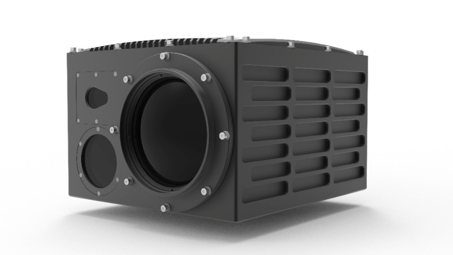
Radar remains the primary sensor for airspace early warning. It utilizes active radio frequency emissions to detect incoming targets. The system measures the Radar Cross Section (RCS) and kinematics, including speed, trajectory, and altitude. Modern counter-drone radars typically operate in the X-band or S-band frequencies to balance resolution and range.
The primary advantage of radar is its true all-weather capability. It penetrates rain, fog, snow, and darkness without performance loss. Radar provides long-range detection and can track dozens of simultaneous targets. Most importantly, it is the only reliable way to detect autonomous drones flying without active radio links.
However, radar has distinct limitations. Traditional 2D systems struggle with false alarms in urban environments and fail to provide the elevation data necessary to point a camera. Furthermore, modern drones use composite materials and plastics. These materials create a very small RCS, often similar to a small bird. Defeating this requires advanced 3D radar or continuous-wave systems that analyze the micro-Doppler signature of the drone's propulsion system.
Visual verification is a mandatory step in the engagement process. You cannot blindly jam or shoot down a radar track without knowing exactly what it is. You must rely on an EO/IR Camera for positive target identification before deploying any countermeasures.
These systems rely on high-magnification visual lenses and thermal sensors. They provide critical visual evidence, allowing operators to see if a drone is carrying an explosive payload or a camera gimbal. They operate passively, emitting zero signals. Thermal imaging, specifically Mid-Wave Infrared (MWIR), makes them highly effective in both day and night conditions by detecting the heat generated by the drone's motors against the cold sky.
The main limitation is their strict reliance on line-of-sight. If a building or tree line blocks the camera, you lose the track. Performance also degrades significantly in heavy rain, snow, or dense fog. Cameras have a very narrow field of view at high magnification. They cannot search the entire sky effectively. They require automated slew-to-cue commands from a radar or RF sensor to point them directly at the target.
RF analyzers passively scan radio spectrums to detect communication signals between drones and their operators, including control instructions, telemetry data and video streams. Advanced systems compare captured signal packets against built-in threat libraries to recognize drone signatures. These sensors will not trigger false alerts from objects without radio emissions such as birds and balloons, and they can identify the drone’s brand, model and serial number. Multi-antenna RF devices can triangulate signals to locate the pilot, so security teams can catch the operator instead of only disabling the drone. However, RF analyzers cannot detect autonomous drones flying with pre-set GPS routes and no radio transmission. Dense urban radio noise and frequency-hopping signals on modern drones also reduce detection performance for basic RF scanners.
| Technology | Primary Function | Weather Dependency | Autonomous Drone Detection | False Alarm Risk |
|---|---|---|---|---|
| 3D Radar | Active tracking, range, speed, altitude | Low (All-weather) | High (Detects physical object) | Moderate (Requires micro-Doppler filtering) |
| Optical/Thermal Cameras | Visual identification, payload verification | High (Degraded by fog, heavy rain) | High (If cued by radar) | Low (Provides visual confirmation) |
| RF Analyzers | Signal detection, pilot geolocation | Low | Zero (Blind to radio silence) | Low (Only detects active transmissions) |
| Acoustic Sensors | Audio signature matching | Moderate (Wind noise interference) | Moderate (Short range only) | High (Urban background noise) |
RF jamming is the widely used non-kinetic countermeasure. It transmits high-power noise to jam 2.4GHz, 5.8GHz and GPS signals, cutting off the connection between the drone and its operator. This makes consumer drones hover, land or return home automatically. Jamming runs continuously without ammo reloads, available as handheld directional jamming rifles or fixed omnidirectional stations. Still, jamming cannot stop radio-silent autonomous drones, and broad omnidirectional jamming may interfere with nearby civilian communications and emergency services. Cyber takeover is a more accurate option: it decodes drone signals and sends fake commands to seize control, guiding the drone to land safely in a preset area without disrupting surrounding radio infrastructure.
Directed energy tools are advanced anti-drone solutions. High-energy lasers focus light to burn drone frames, rotors or optical sensors quickly. High-Power Microwave (HPM) releases broad electromagnetic pulses to disable drone electronics instantly. Both strike targets at light speed, and HPM can neutralize multiple drones in a swarm with one pulse. But these technologies have clear limits: laser power drops sharply in fog, rain or smoke. They also need large power supplies and cooling equipment, which complicates mobile deployment. Misaimed laser beams may injure people or damage aircraft, bringing serious collateral hazards.
Kinetic interception physically captures or destroys incoming drones, using pneumatic net launchers, collision interceptor drones or programmable airburst artillery. It delivers confirmed threat removal and usually has fewer radio-spectrum regulatory restrictions than RF jamming. Net capture can retrieve intact drones for forensic investigation. However, most kinetic tools have short working ranges and need resetting or reloading after each use, so they struggle against drone swarms. The biggest risk is falling debris from destroyed drones; crashed lithium battery drones pose major dangers near crowds or fuel facilities.
Standalone sensors fail in real-world scenarios. An isolated radar might detect a track, but a human operator must manually find that track on a separate camera system. This creates a critical time delay. Drones move fast. A delay of ten seconds can mean the difference between a successful interception and a perimeter breach.
You need a comprehensive counter drone system that utilizes AI-enhanced sensor fusion. Command and Control (C2) software serves as the brain of the operation. It ingests data from all sensors simultaneously and applies Kalman filtering to predict flight paths. When the radar detects a track, the C2 software automatically cues the camera to pan, tilt, and zoom to that exact location in milliseconds. The AI classifies the object as a drone, a bird, or an aircraft. If it is a drone, the software primes the RF jammer or kinetic effector.
This automation drastically reduces operator cognitive load. It removes human hesitation from the kill chain. The operator simply watches the screen, verifies the AI's classification, and authorizes the defeat mechanism. The software handles the complex geometry of tracking and targeting.
Drone technology evolves rapidly. The protection system you install today must adapt to the threats of tomorrow. You must prioritize scalability and modularity in your architecture.
Select systems built on open ecosystems with accessible APIs. Proprietary, closed systems lock you into a single vendor's hardware. If that vendor fails to update their threat library, your system becomes obsolete. Open architectures allow you to integrate emerging technologies as they become available. You can add quantum radar, advanced acoustic sensors, or new cyber takeover modules without replacing your entire C2 infrastructure.
A single-sensor approach leaves your airspace vulnerable. A reliable protection architecture requires a fused network of radar, optical, and radio frequency sensors. You must pair this detection grid with context-appropriate, legally compliant mitigation tools.
To secure your facility, take the following actions:
Conduct a comprehensive site survey to map local RF noise, topographical blind spots, and line-of-sight obstructions.
Define your strict regulatory boundaries and consult legal counsel regarding your authority to deploy active mitigation technologies.
Demand live vendor demonstrations in your actual operating environment, refusing sterile, pre-planned test conditions.
Prioritize open-architecture Command and Control software that allows for future sensor integration and automated threat verification.
A: Urban environments require systems that handle high RF noise and physical obstructions. A combination of distributed RF analyzers and networked optical cameras works best. Radar is often degraded by building clutter. Mitigation should focus on cyber takeover or localized directional jamming to prevent collateral disruption to city infrastructure.
A: Yes, but with limitations. Modern cameras use AI to scan the sky and identify drone profiles. However, their narrow field of view makes wide-area search inefficient. They perform best when cued by a wider-area sensor like radar, which points the camera directly at the suspected target.
A: In most countries, including the United States, private businesses cannot legally operate RF jammers. The FCC strictly prohibits unauthorized jamming of communications. Only specific federal agencies and military units hold the legal authority to deploy active RF disruption technologies.
A: Autonomous drones navigating via pre-programmed waypoints emit no RF signals. You must rely on active radar to detect their physical presence. Once detected, you must use kinetic effectors, lasers, or GPS spoofing to neutralize them, as standard RF communication jamming will have no effect.
A: GPS jamming floods the receiver with noise, causing the drone to lose its location data. It usually triggers a hover or landing protocol. GPS spoofing transmits fake satellite data to the drone, tricking it into believing it is in a different location. Spoofing can force the drone to fly away from your facility.
A: No single sensor is perfect. Radar provides range but lacks visual ID. Cameras provide visual ID but struggle in fog. RF scanners detect signals but miss autonomous threats. Sensor fusion software combines these data streams, eliminating the weaknesses of individual sensors and providing a single, accurate threat picture.