Ryan Optoelectronic modern office and R&D building
Home » Products » Vehicle-Mounted Imaging System » Multi-Spectral Imaging System » Advanced Multi-Spectral Detection Imager

loading

Advanced Multi-Spectral Detection Imager

Multi-spectral imaging is an advanced technology that captures image data of a scene simultaneously at multiple discrete wavelength bands. It goes beyond the limitations of the human eye and conventional cameras, which only perceive red, green, and blue primaries, allowing us to acquire information beyond the visible light (e.g., near-infrared). The system works by separating incoming light into specific bands using optical components like filters or prisms. Multi-spectral imaging has a wide range of applications, including monitoring crop health in precision agriculture, assessing disasters in environmental remote sensing, identifying camouflage in military fields, and restoring and authenticating ancient paintings in cultural heritage. Its core advantage lies in revealing details invisible to the human eye, enabling objective and accurate non-destructive testing through the spectral signatures of materials, thereby providing powerful data support for decision-making across various industries.
Availability:


Overview of Product


The Multi-Spectral Imaging System is an advanced electro-optical technology that captures image data across 8+ discrete spectral bands simultaneously, transcending the limitations of human vision and conventional cameras. By separating incoming light into specific wavelengths—including visible, near-infrared, and short-wave infrared—using precision optical filters and prisms, the system creates a "data cube" that combines spatial and spectral information. Each pixel carries a unique spectral fingerprint, revealing intrinsic properties of materials, objects, or environments that are invisible to the naked eye. This solution integrates precision optics, spectroscopy, and AI-driven data processing to deliver non-destructive, quantitative analysis, addressing complex optical challenges in agriculture, military, industrial inspection, and cultural heritage conservation. As an all-weather, AI-powered system, it transforms multi-dimensional data into actionable intelligence, enabling users to make precise, data-driven decisions in diverse environments.


Advanced Multi-Spectral Detection Imager


Product Features


Multi-Dimensional Perception Beyond Visual Limits

The system’s core advantage lies in its ability to achieve multi-dimensional target perception, going beyond traditional color imaging to capture spectral data that reveals hidden details. It operates across 8–16 discrete spectral bands (customizable based on application), including visible light (400–700 nm), near-infrared (700–1700 nm), and short-wave infrared (1700–2500 nm). This broad spectral coverage allows it to distinguish between materials with similar visual appearances—such as healthy vs. diseased crops, or authentic vs. counterfeit artwork—by analyzing their unique spectral responses. The integrated "data cube" processing enables users to visualize and analyze spectral information at the pixel level, turning raw data into meaningful insights.


Non-Destructive & Quantitative Analysis Capability

A key feature of the Multi-Spectral Imaging System is its non-destructive, non-contact inspection capability, allowing precise analysis without damaging the target object. Leveraging advanced AI algorithms and spectral signature databases, the system translates subtle spectral differences into quantifiable data—such as vegetation health indices (NDVI), material composition percentages, or temperature distributions. For example, in industrial sorting, it can identify foreign materials with an accuracy of 99.5%, while in agriculture, it measures crop moisture content with a margin of error of ±2%. This quantitative analysis elevates decision-making from subjective judgment to objective, repeatable results, making it invaluable for quality control, scientific research, and resource management.


Deep Technology-Application Integration

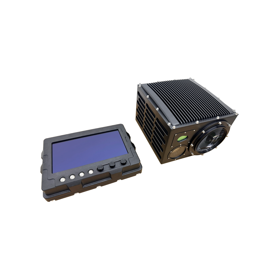
Unlike standalone hardware, this system is a highly integrated solution that combines optics, spectroscopy, and AI processing to deliver end-to-end application-specific results. It features real-time data processing (latency ≤1 second) and customizable software modules tailored to industry needs—such as variable rate application maps for precision agriculture, foreign object detection for manufacturing, or camouflage detection for military use. The system seamlessly integrates with drones, inspection vehicles, and fixed platforms, supporting both mobile and stationary deployments. Its open API allows integration with third-party software and IoT systems, enabling centralized data management and remote monitoring.


All-Weather & Extreme Environment Adaptability

Engineered for rugged performance, the Multi-Spectral Imaging System operates reliably in harsh conditions, with an operating temperature range of -30℃ to 70℃ and IP67 protection against dust and water. It features anti-glare, fog-penetration, and low-light enhancement technologies, ensuring consistent performance in rain, fog, snow, or bright sunlight. The system’s robust housing resists corrosion and physical impact, making it suitable for outdoor applications like environmental monitoring, border surveillance, and infrastructure inspection. For low-power mobile deployments (e.g., drone-mounted), it consumes only 35W during operation, extending battery life for extended missions.


Applications


Military & Police Security & Law Enforcement

In military and police settings, the system serves as a powerful tool for all-weather, anti-camouflage target detection. It penetrates light fog, smoke, and dust, providing clear imaging in pitch-dark conditions (0 lux) to support patrols, border surveillance, and counter-terrorism operations. Its near-infrared and short-wave infrared bands can detect personnel or equipment concealed in vegetation or under camouflage nets—exposing targets whose spectral signatures differ from natural foliage. For VIP protection and major event security, it identifies potential risks through thermal hotspot detection and abnormal movement analysis, providing critical early warning for security teams.


Intelligent Transportation & Public Safety

Mounted on emergency vehicles (police cars, fire trucks, ambulances) and traffic monitoring stations, the system enhances visual capabilities in adverse conditions. It cuts through heavy smoke, rain, or fog to provide drivers with clear road visibility, ensuring safe and rapid response. In traffic accident investigation, it detects subtle marks on vehicle surfaces or skid residue using spectral analysis, supporting accurate scene reconstruction. For public safety, it identifies left-behind objects, crowd density anomalies, and abnormal body temperature distributions (detection accuracy ±0.3℃), enabling proactive risk mitigation in crowded areas.


Specialized Vehicle & Industrial Infrastructure Inspection

For industrial inspection vehicles in oil, gas, and power sectors, the system enables rapid, non-destructive inspection of linear infrastructure. It detects anomalies like pipeline insulation damage, electrical equipment overheating, or structural corrosion by analyzing spectral changes in materials. In agriculture and forestry, drone-mounted systems assess crop health, pest infestations, and water stress across large areas, generating variable rate application maps that optimize resource use. In cultural heritage conservation, it reveals hidden layers or restoration work in ancient paintings and artifacts without physical contact, supporting preservation efforts.


FAQ


How many spectral bands can the system be customized to capture?

The standard system supports 8–16 discrete spectral bands, with customization options for up to 24 bands based on specific application requirements. We work with you to select the optimal wavelength range—from visible light to short-wave infrared—to address your unique optical challenges.


Can the system process and analyze data in real time?

Yes, the system features on-board AI processing with a latency of ≤1 second, enabling real-time data analysis and alert generation. It can transmit processed insights—such as defect detection alerts or target identification—to a central control platform or mobile device, supporting immediate decision-making.


What is the maximum detection distance for the system?

The detection distance varies by spectral band and application: in visible light, it can identify targets up to 3km; in near-infrared, up to 5km; and in short-wave infrared (for industrial or military use), up to 8km. Customized lens options are available to extend range for specific use cases.


Is the system compatible with drone and vehicle-mounted platforms?

Absolutely. The system is designed for seamless integration with most drones, inspection vehicles, and fixed installations. It features a lightweight design (starting at 4.5kg) for drone mounting and standard mounting interfaces for vehicle integration. We provide integration support and customized brackets to ensure compatibility with your existing platforms.


Click here to make an enquiry


Related Products

The U-shaped Gyro Stabilization System is purpose-built for heavy payloads and complex missions. U-shaped open-frame design allows seamless integration of long-range cameras, multi-sensor arrays, and laser systems.
 
Featuring dual-axis stabilization, even during high-speed maneuvers, strong winds, or heavy seas, u-shaped gyro stabilization system maintains stable and clear imaging, enabling real-time monitoring, long-range identification, and evidence-grade recording. With military-grade protection and reliability, the u-shaped gyro-stabilized imaging system excels in maritime surveillance, military reconnaissance, counter-UAV operations, and industrial inspections.
0
0
The Globe-shaped Gyro Stabilization System is an integrated and highly stable electro-optical observation and imaging platform. Utilizing advanced gyro-stabilization technology, globe-shaped gyro stabilization system ensures clear and steady imagery even under complex environments and high-speed motion.
 
Its spherical design enables full-range rotation and wide field-of-view coverage, while supporting flexible integration of multiple sensors and optical payloads. With strong vibration resistance and high reliability, this gyro stabilization system is widely used in aerial, maritime, and ground surveillance missions, including border patrol, maritime law enforcement, aerial reconnaissance, and environmental monitoring. The globe-shaped gyro stabilization system provides reliable support for all-weather, all-directional target observation and intelligence acquisition.
0
0
Equipped with high-definition visible light, infrared thermal imaging, and laser night vision for complementary detection, the marine gyro-stabilized imaging system rapidly locks onto targets and deploys multi-band countermeasures when required.It provides 24/7 monitoring and evidence collection over waterways, coastal areas, ports, lakes, and dams. 
 
Featuring 360° wave-resistant stabilization and 0.05° precision tracking, gyro-stabilized camera ensures rock-steady imaging even in rough seas. Powered by military-grade gyro stabilization technology, this system redefines maritime surveillance standards—delivering land-like stability on turbulent waters. To meet the needs of large-scale deployment and cost-sensitive operations, RYAN provide a Cost-Effective Universal Model, which inherits the core gyro stabilization technology while optimizing for accessibility and practicality.
0
0
The short wave infrared (SWIR) thermal cameras operate in the 0.9–3 μm spectrum, detecting reflected infrared radiation rather than relying solely on emitted heat. The imaging of short wave Infrared (SWIR) thermal camera closely resembles visible light, offering sharp details and the ability to see through glass.
 
With high resolution and adaptability to bright or complex lighting conditions, short wave infrared (SWIR) thermal cameras excel in industrial inspection, scientific research, night vision enhancement, and detecting camouflaged targets. Built-in high-performance digital processor, using high-efficiency compression algorithm, the video is clear, real-time and smooth. We also provide flexible small-batch customization, tailoring systems to specific mission requirements and operational environments.
0
0
Our long-range long wave thermal (LWIR) cameras deliver exceptional image quality with sharp, high-contrast thermal imagery, offering unmatched detail, clarity, and fidelity in even the most demanding environments. Designed for 24/7 day-and-night surveillance, long wave thermal (LWIR) cameras provide superior thermal resolution for mission-critical applications such as border protection, coastal monitoring, and securing critical infrastructure. 
 
With cutting-edge technology and precise performance, long wave thermal (LWIR) imaging systems ensure reliable operation in any conditions. We specialize in custom engineering these systems to meet your specific requirements, incorporating virtually any add-on feature into our advanced gyro-stabilized systems and pan tilts/ gimbal platforms, making them ideal for a wide range of applications.
0
0
The u-shaped pan tilt system is an advanced sighting and tracking system that integrates high-precision optical sensors (HD visible-light cameras, infrared thermal imagers, laser rangefinders, etc.) with a high-speed, high-precision servo-controlled rotational mechanism.
 
Its most distinctive external feature is its u-shaped support structure, it achieves movement in two degrees of freedom, enabling it to rapidly, stably, and precisely point and lock the optical sensors onto any target in space. Leveraging its unique u-shaped configuration, the high-speed u-shaped pan tilt achieves a perfect balance of rigidity, precision, speed, and stability. The u-shaped pan tilt system serves as the core platform for modern high-end observation, tracking, and targeting systems, with wide-ranging applications across critical domains from the battlefield to the city.
0
0
Anti UAV System is an integrated defense solution designed to detect, identify, track, and neutralize various types of drones, including fixed-wing, multi-rotor, and hybrid platforms. 
 
With the rapid proliferation of drones in military operations, security, aerial photography, and logistics, the risks posed by unauthorized or hostile UAVs are growing significantly. Anti UAV Systems have therefore emerged as a critical safeguard, widely deployed to secure airspace, prevent information leakage, and protect critical assets as well as public safety.
0
0

QUICK LINKS

PRODUCTS

CONTACT

Phone:+86-17660204088 
Email: info@ryanoptics.com
Add:Room 904, Building 22, CCCC Intelligent Industrial Park, Yushan Road No.5868, Licheng, Jinan, Shandong

SUBSCRIBE

​Copyright © 2025 Ryan Optics Technology Co., Ltd.  All Rights Reserved. Sitemap |  Privacy Policy